Difference between revisions of "Yellowknife, Canada"
| Line 17: | Line 17: | ||
| − | |||
| − | + | ||
| + | =='''Climate'''== | ||
| + | |||
| + | ===''Climate Zone''=== [[http://geography.about.com/library/weekly/aa011700b.htm]] | ||
Dfc (Subarctic) on the Köppen Climate Chart | Dfc (Subarctic) on the Köppen Climate Chart | ||
| Line 25: | Line 27: | ||
Cities with similar climates include Irkutsk, Russia [[Earth Science 7-Irkutsk,Russia]] and St. Petersburg, Russia | Cities with similar climates include Irkutsk, Russia [[Earth Science 7-Irkutsk,Russia]] and St. Petersburg, Russia | ||
| − | === | + | ===''Average Monthly Tempratures in Centigrade:''=== [[http://www.climatetemp.info/canada/yellowknife-northwest-territories.html]] |
'''Max.''' , '''Min.''' | '''Max.''' , '''Min.''' | ||
| Line 53: | Line 55: | ||
'''Dec.''' -19 , -28 | '''Dec.''' -19 , -28 | ||
| − | === | + | ===''Average Precipitation''=== [[http://weather.uk.msn.com/monthly_averages.aspx?wealocations=wc:CAXX0557]] |
'''Average Precipitiation (inches) , Days with Precipitiation, Average Snowfall (inches)''' | '''Average Precipitiation (inches) , Days with Precipitiation, Average Snowfall (inches)''' | ||
| Line 83: | Line 85: | ||
'''Annual''' 11.051, 119, 59.76 | '''Annual''' 11.051, 119, 59.76 | ||
| − | === | + | ===''Factors that Regulate the Climate''=== [[http://en.wikipedia.org/wiki/Yellowknife]] |
Yellowknife is located on the Canadian Shield. It's topography is very rocky and hilly, with many small lakes including the larger Great Slave Lake. Pine and birch trees and bushes are abundant in the area, but there are also many areas with bare rock. Thanks to its location on Great Slave Lake, Yellowknife has a set growing season. Most of the precipitation falls between June and October. April is the driest month and August is the wettest. | Yellowknife is located on the Canadian Shield. It's topography is very rocky and hilly, with many small lakes including the larger Great Slave Lake. Pine and birch trees and bushes are abundant in the area, but there are also many areas with bare rock. Thanks to its location on Great Slave Lake, Yellowknife has a set growing season. Most of the precipitation falls between June and October. April is the driest month and August is the wettest. | ||
Revision as of 21:52, 14 November 2010
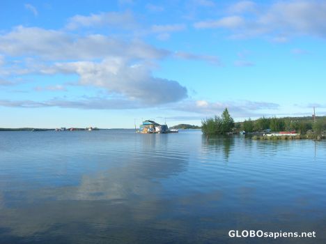
Yellowknife, Northwest Territories, Canada

Country: Canada
Latitude/Longitude: 62°28'36.48"N/114°24'44"W
Elevation: 205 meters
Major Bodies of Water: Slave Lake is the largest, but there are many lakes surrounding Yellowknife.
Climate
===Climate Zone=== [[1]]
Dfc (Subarctic) on the Köppen Climate Chart
Cities with similar climates include Irkutsk, Russia Earth Science 7-Irkutsk,Russia and St. Petersburg, Russia
===Average Monthly Tempratures in Centigrade:=== [[2]]
Max. , Min.
Jan. -23 , -32
Feb. -21 , -31
Mar. -12 , -24
Apr. -2 , -13
May 9 , -1
Jun. 17 , 7
Jul. 20 , 11
Aug. 18 , 10
Sep. 11 , 4
Oct. 2 , -4
Nov. -10 , -17
Dec. -19 , -28
===Average Precipitation=== [[3]]
Average Precipitiation (inches) , Days with Precipitiation, Average Snowfall (inches)
Jan 0.555, 11.2, 7.4
Feb 0.506, 9.0, 7.01
March 0.528, 8.2, 6.81
Apr 0.425, 5.4, 4.02
May 0.752, 6.7, 7.11
Jun 1.059, 7.5, 0.0
Jul 1.378, 9.5, 0.0
Aug 1.61, 10.1, 0.04
Sep 1.295, 10.8, 1.22
Oct 1.378, 14.2, 9.06
Nov 0.925, 14.4, 13.46
Dec 0.642, 12.0, 9.06
Annual 11.051, 119, 59.76
===Factors that Regulate the Climate=== [[4]]
Yellowknife is located on the Canadian Shield. It's topography is very rocky and hilly, with many small lakes including the larger Great Slave Lake. Pine and birch trees and bushes are abundant in the area, but there are also many areas with bare rock. Thanks to its location on Great Slave Lake, Yellowknife has a set growing season. Most of the precipitation falls between June and October. April is the driest month and August is the wettest.