Earth Science 7- Northern Asia 2
Earth Science 7-Global Regions Index
Contents
Northern Asia
 ,
[1]
,
[1]
Countries
Japan
China
Mongolia
Korea
Russia
Afghanistan
Uzbekistan
Turkmenistan
Tajikistan
Kyrgyzstan
Kazakhstan
Taiwan. 1
Latitude and Longitude
Latitude: 18-81 degrees North. 1
Longitude: 28 degrees East, 169 degrees West. 1
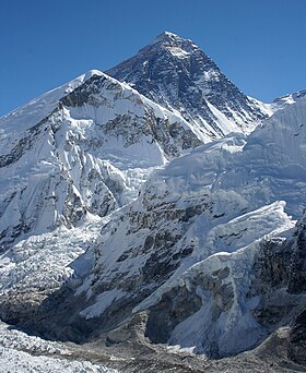
Elevation Range
The highest point is Mount Everest with 8,850 m. 1
The lowest point is The Caspian Sea with -132 m. 1
Bordering Oceans
Pacific Ocean
Arctic Ocean. 1
Tides
Mixed tides, where successive high-water and low-water stands, are placed on the southern part of Northern Asia. Diurnal tides, tides have one high and one low water per tidal day, are found in the middle coast. The most common tide is the Semi-diurnal tides, which have two high and two low waters per tidal day. 7
Large Bodies of Water
Lake Decalog
Korea Bay
Lake Baikal. 2
Currents
Alaska Current Kamchatka Current Oyashio Current North Pacific Current. 7
Major Seas
Sea of Japan
East China Sea
South China Sea
Yellow Sea. 1
Sea of Japan

Topographic Features
Ural Mountains
Himalayas Mountains
Tibetan Plateau
Gobi Desert
Taklamakan Desert
Subarctic Climate in Siberia
Tundra in Siberia
Altai Mountains
Steppes in Kazakhstan and Mongolia
Hentiyn Mountains. 3
Rivers
Yangtze
Yenisei
Lena
Ob
Amur
The Pearl
Ural River
The Yellow
Lao He. 2
Climate
Much of Northern Asia is part of the climate zone humid continental. 4 Climate types include humid, severe and dry winters, and hot summers. 4 In Northern Asia the main climate tends to include snow, arid, polar, and warm temperatures. 5 Precipitation in Northern Asia falls into the categories of fully humid, desert, and a dry winter. 5 Temperature in Northern Asia varies greatly by which part of the region you are in. 5 The climate is a result of the many climate controls. The climate controls are the several mountain ranges, deserts, tundra, and of course the bordering oceans. More climate controls are the elevation and the latitude.
Deserts occur in Mongolia because of the Mongolian Plateau. Many Plateaus contain deserts.6 Because of the southern winds hitting the Himalayan Mountain range, it creates a much warmer temperature in China. 6 There are several small mountain ranges in Russia which provides for it's snowy weather. 6 Also these small mountains stop warm air currents from the south to create deserts on one side, and blizzards on the other. 6 The winds in Russia flow from the north which then trail down into Siberia, causing a colder climate. 6
References
http://www.cia.gov/library/publications/the-world-factbook/ 1 http://www.tulane.edu/~riomar/images/Chapter%201.pdf 2 http://depts.washington.edu/silkroad/maps/physical/etopo.html 3 http://www.srh.noaa.gov/jetstream/global/climate_max.htm 4 http://koeppen-geiger.vu-wien.ac.at/present.htm 5 Google Earth. 6 http://www.oceanmotion.org/ 7
Links
Image 3:http://www.google.com/imgres?q=Sea+of+Japan&um=1&hl=en&safe=active&client=safari&sa=N&rls=en&biw=1359&bih=1223&tbm=isch&tbnid=XNR-jkZHKZFMjM:&imgrefurl=http://www.123rf.com/photo_1006255_sea-of-japan-rocky-coast.html&docid=j68yIARw5eRdGM&imgurl=http://us.123rf.com/400wm/400/400/tatisol/tatisol0706/tatisol070600018/1006255-sea-of-japan-rocky-coast.jpg&w=400&h=297&ei=sYi2Tr2FNqfosQLT1uD1Aw&zoom=1
Cite error: <ref> tags exist, but no <references/> tag was found