Earth Science 7 - Manila, Philippines
Manila, Philippines
Manila, Philippines is part of a vast metropolitan area near where the Pasig River meets Manila Bay about 1,300 km from the Asian mainland. The city and its suburbs form a government unit called Metro Manila. Metro Manila has the country's cardinal port, and is the center of most of the commercial, industrial, and cultural activities in the Philippines.
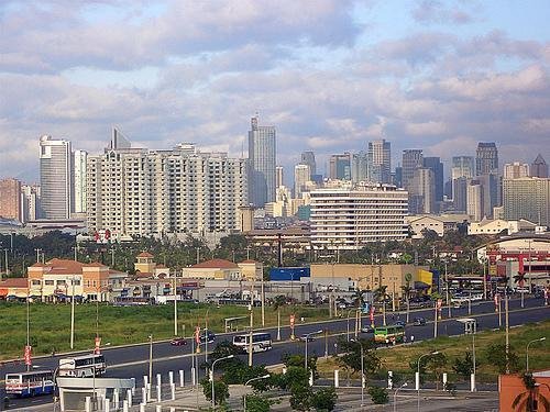
Manila is located at 14°35'00.00N and 120°58'00.00E. It encompasses about 38.3 square km, and its elevation is 18 feet. Manila is on the west coast of Luzon, a Philippine island.

Manila's yearly rainfall is about 2050 mm. Its average monthly high temperature is about 31-34°C, and its average monthly low temperature is about 21-24°C. On the Koppen Classification scale, Manila is split between Af and Am, meaning tropical rainforest and tropical monsoonal. It has a lengthy wet season, and a short dry season, if any.
Manila is located near the Equator, which explains why it stays relatively within the same temperature range. Another factor in this is that Manila is located on Manila bay, keeping it warmer throughout the year.
In terms of geology, Manila is located near to a group of crustal faults, causing earthquakes.
http://earthquake.usgs.gov/research/geology/manila/
http://geography.howstuffworks.com/asia/geography-of-manila.htm