Difference between revisions of "Asia earth science 5"
| Line 52: | Line 52: | ||
==Average Monthly Temperature== | ==Average Monthly Temperature== | ||
| + | |||
Highs: | Highs: | ||
| Line 61: | Line 62: | ||
Climate: | Climate: | ||
| + | |||
| + | Prevailing Winds: | ||
| + | |||
| + | Ocean Currents: | ||
| + | |||
| + | High Pressure Zone: | ||
| + | |||
| + | Low Pressure Zone: | ||
| Line 79: | Line 88: | ||
Climate: | Climate: | ||
| + | |||
| + | Prevailing Winds: | ||
| + | |||
| + | Ocean Currents: | ||
| + | |||
| + | High Pressure Zone: | ||
| + | |||
| + | Low Pressure Zone: | ||
='''Russia'''= | ='''Russia'''= | ||
| Line 96: | Line 113: | ||
Climate: | Climate: | ||
| + | |||
| + | Prevailing Winds: | ||
| + | |||
| + | Ocean Currents: | ||
| + | |||
| + | High Pressure Zone: | ||
| + | |||
| + | Low Pressure Zone: | ||
=''Earth Science 7 Regions Link''= | =''Earth Science 7 Regions Link''= | ||
Revision as of 13:03, 21 November 2011
Asia
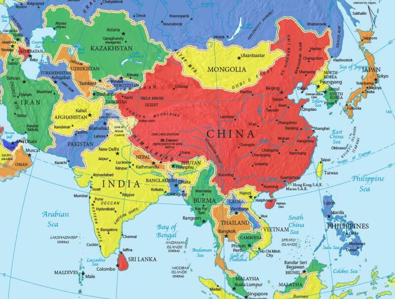 image 1
Countries of Asia
Afghanistan/ Armenia/ Azerbaijan /Bahrain/ Bangladesh/ Bhutan/ Brunei/ Cambodia/ China/ Georgia/ India/ Indonesia/ Iran/ Iraq/ Israel/ Japan/ Jordan/ Kazakhstan/ Kuwait/ Kyrgyzstan/ Laos/ Lebanon/ Malaysia/ Maldives/ Mongolia/ Myanmar/ Nepal/ "North Korea"/ Oman/ Pakistan/ Philippines/ Qatar/ Russia/ "Saudi Arabia"/ Singapore/ "South Korea"/ "Sri Lanka"/ Syria/ Tajikistan/ Thailand/ Timor-Leste/ Turkey Turkmenistan/ "United Arab Emirates"/ Uzbekistan/ Vietnam/ Yemen/
China
 image 2
Longitude and Latitude Ranges
Latitude Range: 49 degrees N-- 19 degrees N Longitude Range: 74 degrees E-- 119 degrees E [2]
Large Bodies of Water
Yangtze River-- 3722 miles long Tonle Sap Lake-- 3860 sq. mi
Bordering Oceans
Pacific Ocean
Major Topographic Features
Qinghai-Tibet Plateau --4000 meters above sea level
Mt. Everest-- 8448 meters above sea level
Mongolia Plateau
Loess Plateau
Yunnan-Guizhou Plateau
Tarim Basin
Junggar Basin
Sichuan Basin
Northeast Plain
North China Plain
Yangtze Plain
Himalaya Mountain Range [3]
Elevation Range
8448 meters above sea level--- 154 meters below sea level [4]
Average Monthly Temperature
Highs:
Lows:
Average Monthly Rainfall:
Climate Zone
Climate:
Prevailing Winds:
Ocean Currents:
High Pressure Zone:
Low Pressure Zone:
Japan
Longitude and Latitude Ranges
Large Bodies of Water
Bordering Oceans
Major Topographic Features
Average Monthly Temperature
Highs:
Lows:
Average Monthly Rainfall:
Climate Zone
Climate:
Prevailing Winds:
Ocean Currents:
High Pressure Zone:
Low Pressure Zone:
Russia
Longitude and Latitude Ranges
Large Bodies of Water
Bordering Oceans
Major Topographic Features
Average Monthly Temperature
Highs:
Lows:
Average Monthly Rainfall:
Climate Zone
Climate:
Prevailing Winds:
Ocean Currents:
High Pressure Zone:
Low Pressure Zone:
Earth Science 7 Regions Link
Earth Science 7-Global Regions Index
Citations
http://www.indexmundi.com/china/elevation_extremes.html
http://lasauniversity.tripod.com/water.html
http://travel.nationalgeographic.com/travel/continents/asia/
http://www.infoplease.com/ipa/A0001763.html