Difference between revisions of "India/Middle East 8"
From SJS Wiki
| Line 33: | Line 33: | ||
Gulf of Aqaba | Gulf of Aqaba | ||
Arabian Gulf | Arabian Gulf | ||
| − | < | + | <ref>https://www.cia.gov/library/publications/the-world-factbook/geos/in.html> |
== '''The Latitude and Longitude Regions-Middle East :''' == | == '''The Latitude and Longitude Regions-Middle East :''' == | ||
Latitude: 30 (N) | Latitude: 30 (N) | ||
| Line 63: | Line 63: | ||
Ganges River | Ganges River | ||
== '''Highest and Lowest Point-India''' == | == '''Highest and Lowest Point-India''' == | ||
| − | The lowest point in India is the Indian Ocean at 0 feet above sea level. The highest point in India is Kangchenjunga at 20,209 ft above sea level. | + | The lowest point in India is the Indian Ocean at 0 feet above sea level. The highest point in India is Kangchenjunga at 20,209 ft above sea level. |
| + | <ref>https://www.cia.gov/library/publications/the-world-factbook/geos/in.html | ||
== '''Latitude and Longitude Coordinates-India''' == | == '''Latitude and Longitude Coordinates-India''' == | ||
| − | 20 00 N, 77 00 E | + | 20 00 N, 77 00 E <ref>https://www.cia.gov/library/publications/the-world-factbook/geos/in.html |
== '''Topographic features-India''' == | == '''Topographic features-India''' == | ||
| − | Deccan Plateau | + | Deccan Plateau <ref>https://www.cia.gov/library/publications/the-world-factbook/geos/in.html |
== '''Bordering Oceans-India''' == | == '''Bordering Oceans-India''' == | ||
| Line 75: | Line 76: | ||
Arabian Sea | Arabian Sea | ||
Laccadive Sea | Laccadive Sea | ||
| − | + | <ref>https://www.cia.gov/library/publications/the-world-factbook/geos/in.html | |
== '''Average Monthly Temperature India''' == | == '''Average Monthly Temperature India''' == | ||
| Line 108: | Line 109: | ||
| | | | ||
|} | |} | ||
| − | <ref>http://www.weatherbase.com/search/search.php3?query=new+delhi+india+snow | + | <ref>http://www.weatherbase.com/search/search.php3?query=new+delhi+india+snow |
| + | |||
=='''Average Monthly Precipitation India'''== | =='''Average Monthly Precipitation India'''== | ||
== '''Average Temperature Middle East''' == | == '''Average Temperature Middle East''' == | ||
| − | + | <ref>http://www.weatherbase.com/ | |
{| | {| | ||
| align="center" style="background:#f0f0f0;"|'''Baghdad, Iraq (BWk) Average Temperature''' | | align="center" style="background:#f0f0f0;"|'''Baghdad, Iraq (BWk) Average Temperature''' | ||
| Line 272: | Line 274: | ||
=='''Average Precipitation Middle East'''== | =='''Average Precipitation Middle East'''== | ||
| + | <ref>http://www.weatherbase.com/ | ||
{| | {| | ||
| align="center" style="background:#f0f0f0;"|'''Baghdad, Iraq (BWk) Average Precipitation''' | | align="center" style="background:#f0f0f0;"|'''Baghdad, Iraq (BWk) Average Precipitation''' | ||
| Line 340: | Line 343: | ||
== '''Vegetation-Middle East''' == | == '''Vegetation-Middle East''' == | ||
There isn't much vegetation in the Middle East. Most of it is desert scrub. | There isn't much vegetation in the Middle East. Most of it is desert scrub. | ||
| − | <ref | + | <ref>http://www.gperfors.com/Middle%20East%20Vegetation.htm |
== '''High and Low Pressure Zones-Middle East''' == | == '''High and Low Pressure Zones-Middle East''' == | ||
The Middle East is currently near a high pressure zone in Asia. This means that wind and storms are blown into the area. | The Middle East is currently near a high pressure zone in Asia. This means that wind and storms are blown into the area. | ||
| − | <ref | + | <ref>http://www.findlocalweather.com/weather_maps/pressure_middle_east.html |
Revision as of 21:18, 4 December 2011
India and the Middle East
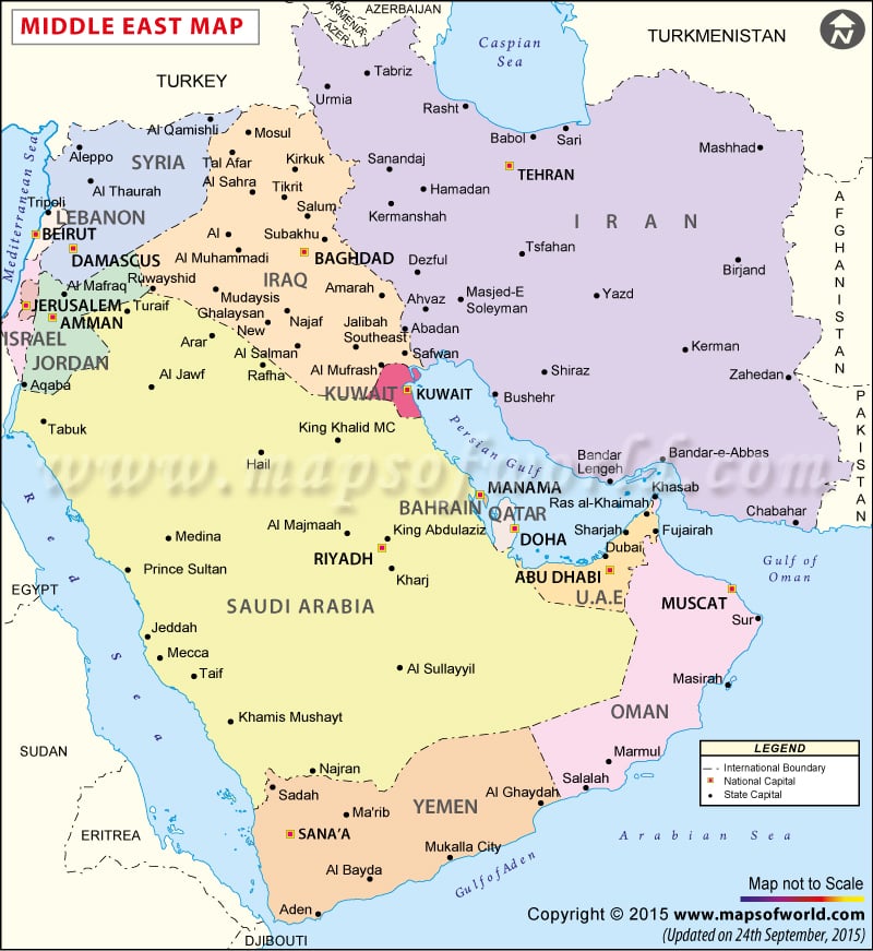
Countries-Middle East: Egypt Iran Turkey Sudan Algeria Morocco Iraq Saudi Arabia Yemen Syria Israel Libya Jordan United Arab Emirates Lebanon Palestinian territories Kuwait Oman Qatar Bahrain
Major Seas-Middle East :
Red Sea
Gulf of Aqaba
Arabian Gulf
Cite error: Closing </ref> missing for <ref> tag