Difference between revisions of "India/Middle East 8"
From SJS Wiki
| Line 29: | Line 29: | ||
Bahrain | Bahrain | ||
| − | |||
| − | |||
| − | |||
| − | |||
| − | + | == '''The Latitude and Longitude Regions-Middle East:''' == | |
| − | + | ||
| − | == '''The Latitude and Longitude Regions-Middle East :''' == | + | |
Latitude: 30 (N) | Latitude: 30 (N) | ||
Longitude: 45 (E) | Longitude: 45 (E) | ||
Revision as of 21:24, 4 December 2011
Contents
India and the Middle East
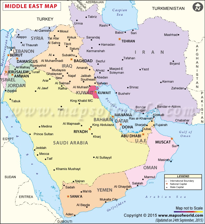
Countries-Middle East: Egypt Iran Turkey Sudan Algeria Morocco Iraq Saudi Arabia Yemen Syria Israel Libya Jordan United Arab Emirates Lebanon Palestinian territories Kuwait Oman Qatar Bahrain
The Latitude and Longitude Regions-Middle East:
Latitude: 30 (N) Longitude: 45 (E)
Elevation Range-Middle East
Lowest: The Dead Sea on the boarder of Israel and Jordan in the Middle its height is 1,388 ft below sea level Highest: Pik Samani at 24,590 ft
Large Bodies of Water-Middle East
Dead Sea Mediterranean Sea Black Sea Red Sea Caspian Sea Arabian Sea
Topographic Features-Middle Est
Rub al Khali dessert Caucasus Mts Elbruz Mts Zagros Mts
Bordering Oceans-Middle East
Indian Ocean
Major Bodies of Water-India
Ganges River
Highest and Lowest Point-India
The lowest point in India is the Indian Ocean at 0 feet above sea level. The highest point in India is Kangchenjunga at 20,209 ft above sea level.
Cite error: Closing </ref> missing for <ref> tag