Earth Science 7 - Middle East2
Earth Science 7-Global Regions Index
Contents
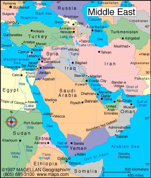
Middle East
The Middle East is a region of the world east of Africa yet west of China. The Middle East is technically not defined as a continent, it is a part of Asia.
List of Middle Eastern Countries
- Afghanistan
- Algeria
- Bahrain
- Egypt
- India
- Iran
- Iraq
- Israel
- Jordan
- Kuwait
- Lebanon
- Libya
- Morocco
- Oman
- Pakistan
- Qatar
- Saudi Arabia
- Somalia
- Syria
- United Arab Emirates
- Tunisia
- Turkey
- Yemen
- Indian Ocean
- Arabian Sea
- Gulf of Aden
- Caspian Sea
- Persian Gulf
- Gulf of Oman
- Red Sea
- Black Sea
- Mediterranean Sea
- Jordan River
- Dead Sea
- Euphrates River
- Tigris River
- Indian Ocean
- Zagros Mts
- Elburz Mts
- Caucasus Mts
- Rub Al Khali Desert
Latitude and Longitude Ranges
46N and 14N longitude. 78E and 27E latitude
Elevation Range
HIghest: 18,406ft above sea level (Mt. Damavand) Lowest: 1,300 ft below sea level (Dead Sea)
Bodies of Water
The Bodies of Water in the Middle East include:
Bordering Oceans
Topographic Features

Oil and Gas Deposits

Historically, the Middle East has had many oil and gas deposits/
Climate
Historically, the Middle East has had an arid climate with mild winters. Climate is hot and dry. Winters are mild with some rain. Hot desert conditions induce a strong seasonal wind pattern in the region, known as the monsoon (Arabic for season).
Koppen Climate Designation
Map of World Climate
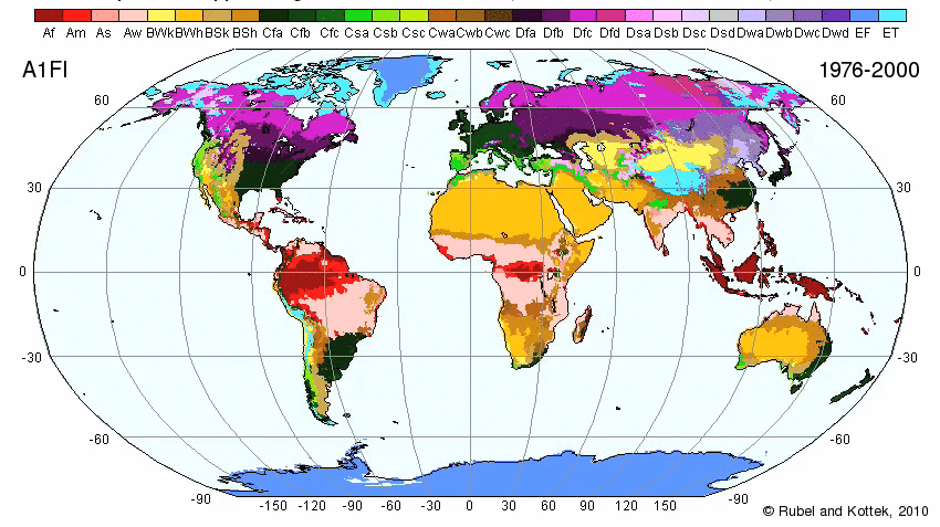
Climate Zones
Armenia
Map
Links/References
[1] (Countries)(Oceans)
[2] (Bodies of Water)
[3] (Climate)
[4] (Climate Map)
References
[5] (About the Köppen Climate Classification System)